Wiky Geomatics
Wiky Geomatics is now offering unique, customized solutions in the areas of property development, site assessments, elevation products, forestry management, and the like.
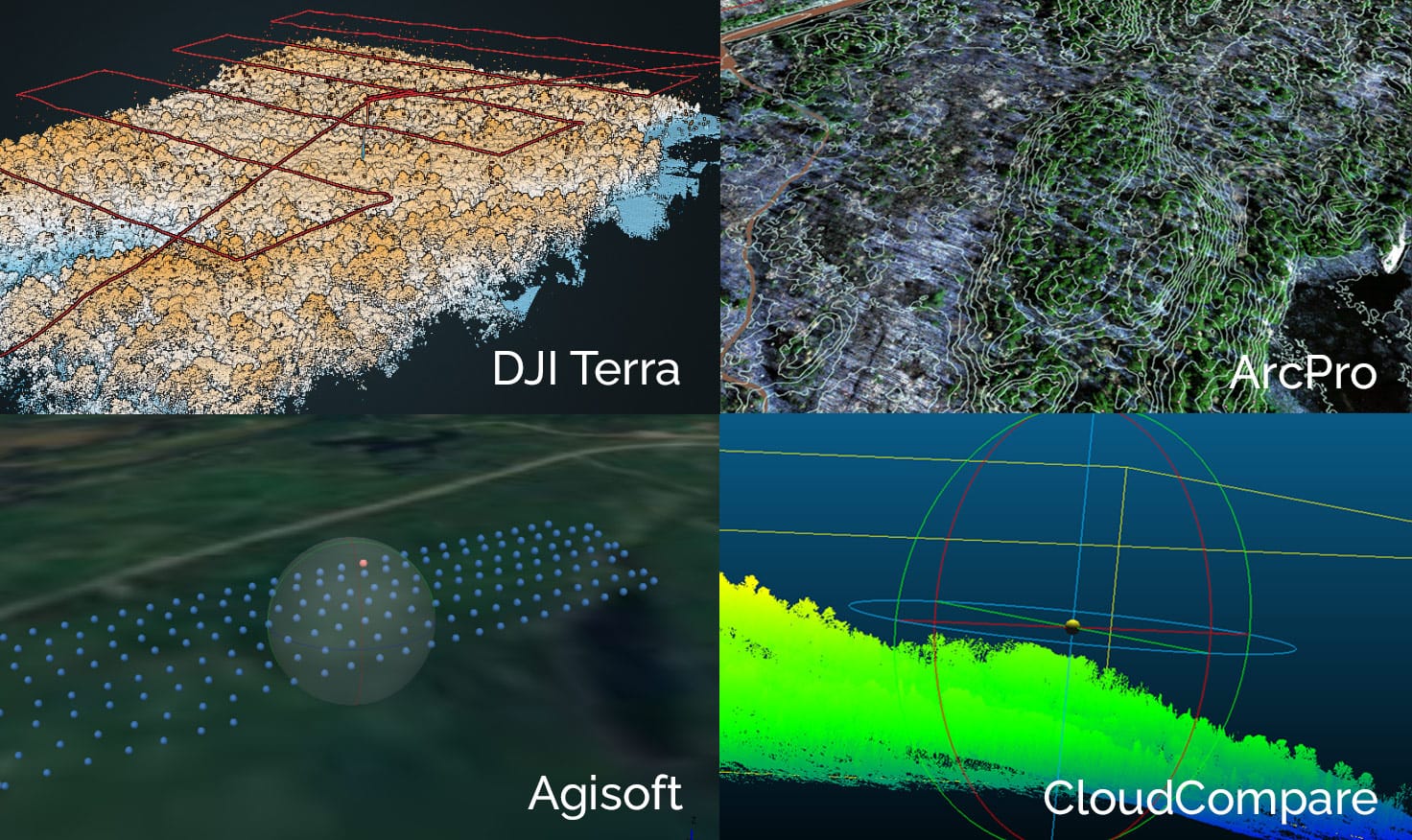
Wiikwemkoong’s Department of Lands & Natural Resources has expanded it’s capabilities to include continually upgraded technology consisting of high-quality multispectral imagery and high resolution LiDAR, capture via unmanned aerial vehicles (drones). This has been combined with sub-meter GNSS field equipment plus a powerful collection of GIS software, and LiDAR and imagery processing software for improved analysis capabilities and highly accurate data collection.
Our focus has been the Algoma through to Sudbury districts and, of course, Manitoulin Island. The Great-Lake St. Lawrence forest region of Ontario offers such a diversity of landscapes and tree species/forest types that analysis requires a more granular and detailed understanding of forest inventory and continuous inventories are necessary for effective and efficient forest management planning and operations.
Wiky Geomatics still seeks to form strategic alliances and partnerships with consulting firms and research partners to join in pursuing opportunities in the afforestation, carbon offset monitoring, aggregates, mining, and civil engineering sectors. Current, ongoing research and development include species identification, UAV based regen surveys and forest stand descriptions.
Our Areas of Focus
Forestry Operations
Woodlots, private landowners, inventory updates – planning, inventories, and orthomosaics
Forestry Renewal & FTG
Stocking, survival, height, health, species identification in smaller areas in GLSL region primarily
Afforestation
Planning – land identification & site-specific assessment. Stocking, survival & height
Mining & Aggregrates
Material deposits, tailings pond condition, cut/fill analysis, site analysis
Property Mapping
Mapping products, building information, imagery products
Our Technology
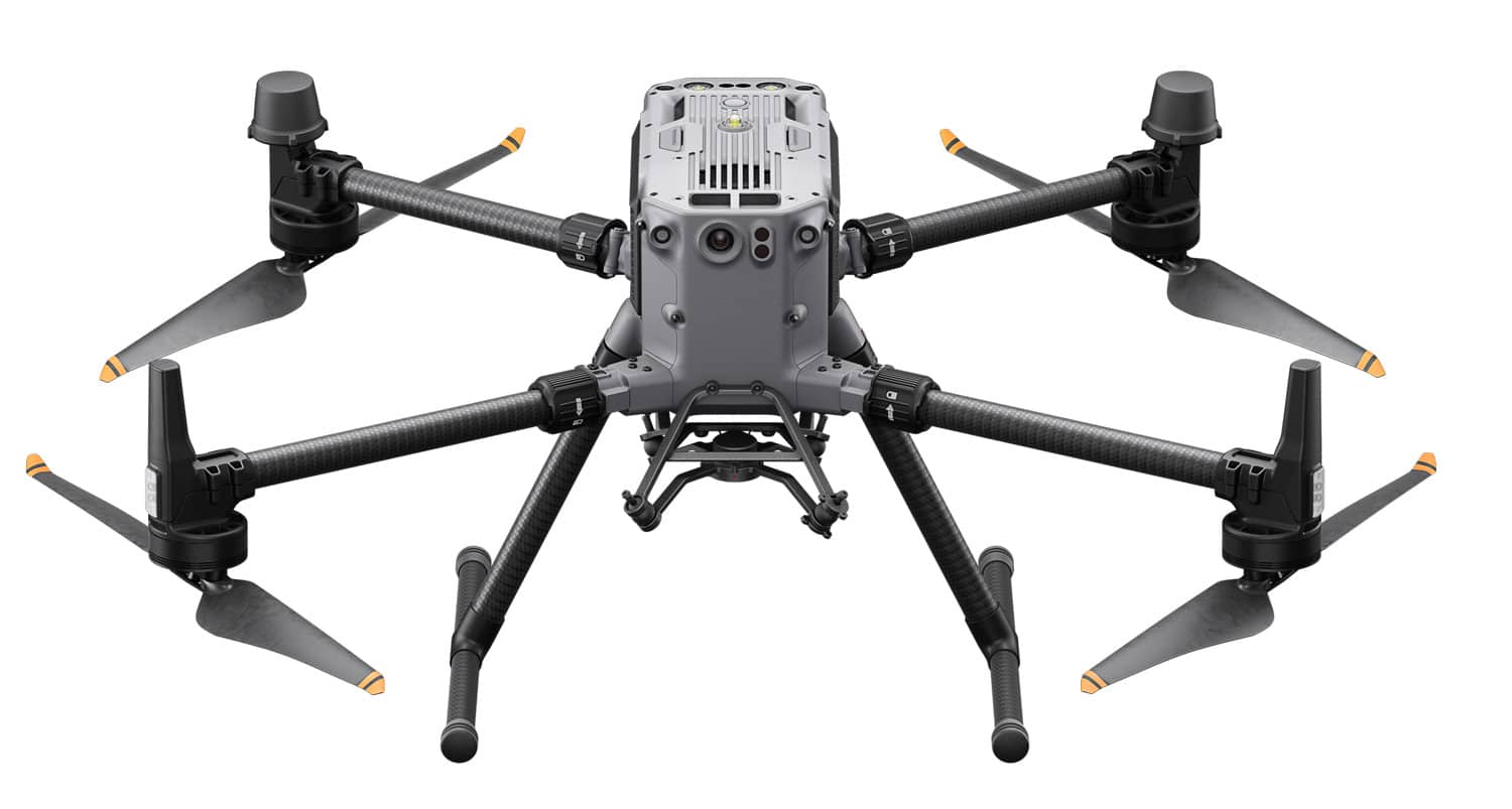
The DJI M300 RTK sets new standards with its enhanced endurance, weather resistance, a new low-light FPV camera, a reoptimized battery system and limitless payload capabilities, allowing you to equip it with the necessary tools and sensors for any mission.
With superior penetration due to smaller laser spots, 5 returns and 4 cm vertical and 5 cm horizontal accuracy, and advanced flight path options, this camera provides high precision capture of terrain and features.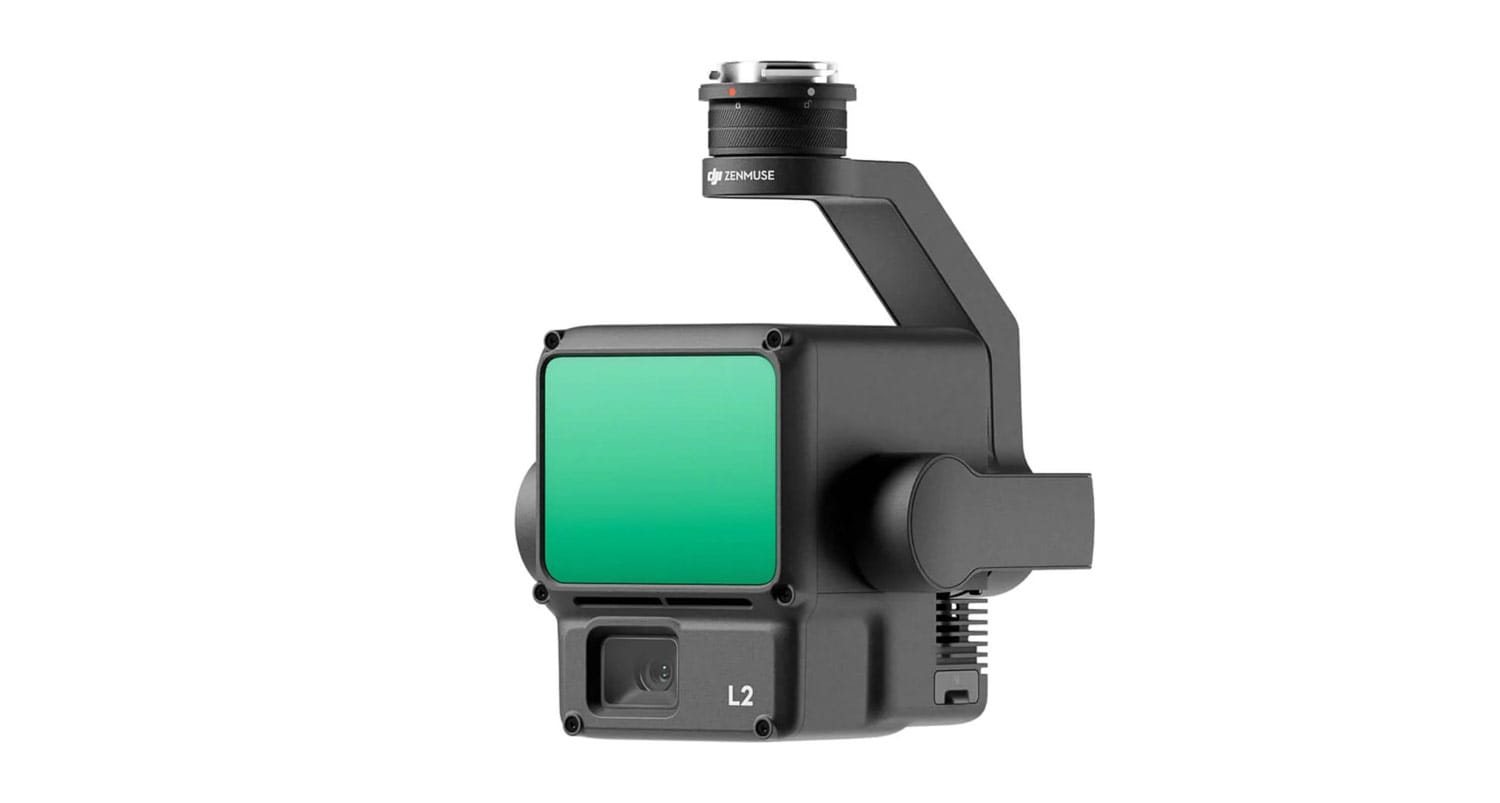
This is the combination of technology we use for sub-meter GPS data capture.

The Juniper Systems Geode GNS3 GNSS Receiver is a precision GNSS receiver, enabling us to collect real-time, centimeter, decimeter, sub-foot, or sub-meter, GNSS data.
A Few of Our Clients

Point Grondine Park
Wiky Geomatics deployed both it’s LiDAR & multispectral UAVs to create high accuracy elevation products to assist in the development of campground sites and a new road, and to identify the individual locations of the towering white pines protected in this reserve area.
Searchmont Resort
Wiky Geomatics is excited to have the opportunity to fly our LiDAR cameras over new and proposed development areas for this fast-growing, Northern Ontario ski & snowboard resort. Our largest project to date, the area captured exceeds 300 hectares, and the high resolution bare earth elevation products were utilized by the resort’s engineering firm for run development and facility expansion.
AOK Sucker Creek & Mud Lake Rehabilitation
Wiky Geomatics assisted in the planning process for the rehabilitation of Sucker Creek & Mud Lake by producing some LiDAR derived elevation products and multispectral imaging to aid in determining vegetation structure. Rehabilitation of this area will enable new tourism and recreation opportunities for Aundeck Omni Kaning.
Ketegaunseebee
A work in progress, Wiky Geomatics paired up with Garden River First Nation’s Lands & Resources Department to update the existing forest inventory and map out newly logged areas using both our high-accuracy GPS technology as well as satellite and drone imagery.
Local Property, Woodlot & Sugarbush Owners
We work to determine tree health, tree species and stand descriptions for local property owners by combining drone and satellite imagery, Esri’s deep-learning image analysis toolset and our sub-meter GPS calibration tree data. Property lines, fence lines, features and topography can all be mapped with 10cm accuracy or greater as well.
Research Partners
Vermilion Forest Management
Canadian Wood Fibre Centre
Nature Conservancy of Canada, Vidal Bay
Forests Ontario (now Forests Canada)
Wiky Geomatics Contact
Suzanne Gunn
GIS Specialist, Business Lead
Wiikwemkoong, Manitoulin Island
& Searchmont, Algoma District,
Ontario, Canada
(250) 910-9867